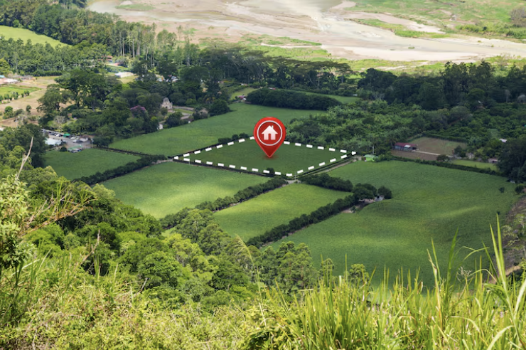
GPS: The Backbone of Modern Land Surveying
Exploring how GPS systems improve speed and accuracy in field measurements.
 Mapping Excellence, Building Trust
With a legacy of operations since 2015 and formal establishment in 2023, NORTH SURVEYORS has become a trusted partner for projects that demand accuracy, reliability, and efficiency. From cadastral boundaries to large-scale engineering layouts, our team blends deep field experience with the latest in GPS, CAD, and drone technology—ensuring every survey is a foundation you can build on.
From cadastral mapping to complex engineering surveys, NORTH SURVEYORS delivers precision-driven results you can depend on. Our team combines years of field experience with advanced GPS, CAD, and drone technology to ensure every project is mapped, measured, and delivered with confidence.

Our Services
From cadastral mapping to advanced engineering surveys, we deliver accurate and reliable results using the latest GPS, CAD, and drone technologies. Our tailored solutions ensure every project is completed with precision, efficiency, and trust.
Accurate land boundary demarcation, plot measurement, subdivision surveys, and land development mapping to support legal, residential, agricultural, and commercial requirements with complete reliability.
Advanced GIS-based data creation, spatial analysis, thematic mapping, and database management to support planning, utilities, infrastructure development, and decision-making processes.
Detailed contour mapping, elevation data collection, natural and man-made feature mapping to support engineering design, construction planning, and environmental studies.
Legal land record surveys, property mapping, ownership boundary verification, and GIS integration for government, urban planning, and land administration projects.
Booking with NORTH SURVEYORS is quick, with fast confirmation to start your project.
 OUR SURVEY PROCESS
With a legacy of operations since 2015 and formal establishment in 2023, NORTH SURVEYORS has become a trusted partner for projects that demand accuracy, reliability, and efficiency. We blend deep field experience with the latest in GPS, CAD, GIS, and drone technology.
Every project starts with clarity. At NORTH SURVEYORS, we take time to understand your requirements so our work aligns with your goals from the outset.
This initial discussion ensures we select the right tools, methods, and approach for maximum efficiency and precision.
Our team conducts a thorough site assessment to identify potential challenges and opportunities.
We analyze terrain, accessibility, and environmental factors to develop a comprehensive survey plan.
Using advanced GPS, CAD, and drone technology, we collect precise field data with accuracy and efficiency.
Our experienced surveyors ensure every measurement meets industry standards and your project requirements.
Collected data is processed using advanced CAD and GIS software to create accurate maps and reports.
Quality control checks ensure precision and compliance with all regulatory requirements.
Final deliverables are provided in your preferred formats, with complete documentation and ongoing support.
We ensure you have everything needed to proceed with confidence and clarity.
Our Projects
From urban infrastructure to environmental preservation, our completed projects
reflect the precision, versatility, and reliability that define

Comprehensive mapping of roads, utilities, and transportation corridors across Maharashtra, Gujarat and Rajasthan.

Detailed land surveys supporting smart city development and municipal planning in Mumbai and other major cities.

Accurate detection and mapping of underground and overhead assets for infrastructure maintenance and expansion.

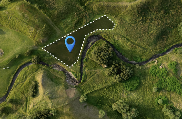
Land and river surveys aiding environmental conservation and sustainable land management projects.
Testimonials
Our reputation is built on accuracy, trust, and client satisfaction. Here’s what our partners and clients have to say about working with NORTH SURVEYORS.

LATEST NEWS
Stay informed with the latest trends, technologies, and project stories from the world of land and engineering surveys.
Exploring how GPS systems improve speed and accuracy in field measurements.

How aerial data collection is changing construction and planning.
Methods and tools that ensure precision in every survey.
Frequently Asked Questions
Clear, straightforward answers to the most common questions about our surveying services.
OUR PARTNERS
We take pride in collaborating with visionary companies, delivering precision-driven results that build the foundations of tomorrow.